I've heard of all the rest but not Lake Huron, out of sight out of mind maybe.
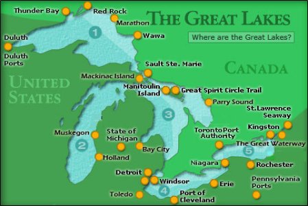
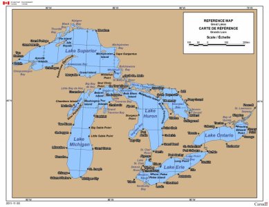
It's the one in the middle. Looks like a guy with a backpack.
To register, turn off your VPN; you can re-enable the VPN after registration. You must maintain an active email address on your account: disposable email addresses cannot be used to register.
I've heard of all the rest but not Lake Huron, out of sight out of mind maybe.
And where exactly are Florida, New York or California a map? According to my info they are the names of U.S. states, and as such can be found ON maps....... Never seen them actually BE maps.

Actually, Lake Superior takes its name from being above Lake Huron, not due to its size.
That's interesting....I teach Grade 5. Geography is a major component of my curriculum. I teach map skills.
It is a big country with lots of geography. Huron is the most obscure of the lakes. I think it has been several years since I have heard it mentioned.
That's interesting.
There are some recent studies that say that we're losing the ability to read and navigate via maps- probably because more and more people depend on GPS and their phone apps to navigate for them.
And there's those stories about people driving into rivers and lakes because they were expecting their phone to be a better navigation tool than their own eyes.
http://www.motherjones.com/media/2016/11/gps-brain-function-memory-navigation-maps-apps/
http://www.npr.org/templates/story/story.php?storyId=124608376
I was going to Martinez via HWY 680 and I know how to get there since I have been there 50 times but I was trying to figure out how to go in on HWY 4 which is just a couple exits before the one I usually go to....and the damn GPS on my phone kept trying to take me through Walnut Creek which is 20 damn cities down the HWY...I think I would have ended up on Mount Diablo if I had listened to the bitch on the phone....and I got in a fight with my phone and had to disable it...turning it off and on didn't do the trick...
I was going to Martinez via HWY 680 and I know how to get there since I have been there 50 times but I was trying to figure out how to go in on HWY 4 which is just a couple exits before the one I usually go to....and the damn GPS on my phone kept trying to take me through Walnut Creek which is 20 damn cities down the HWY...I think I would have ended up on Mount Diablo if I had listened to the bitch on the phone....and I got in a fight with my phone and had to disable it...turning it off and on didn't do the trick...
I drove circles around Washington DC following my gps looking for the National zoo. I passed it about 4 times to my left, while my gps told me to turn right the whole time.
Just something to think about. Maps are our friends, as long as they were created by competent mapmakers. Sadly that is a dying skill as we leave the direction finding in the incapable hands of computers more and more.
By the shore of Gitche GumeeThat was the French name for the lake, le lac supérieur. Properly translated, the expression means "Upper Lake," that is, the lake above Lake Huron. The original native American name was gitchi-gami. Meaning "be a great sea" Everyone who's heard Gordon Lightfoot's The Wreck of the Edmund Fitzgerald had heard of it. The British, upon taking control of the region from the French in the 1760s following the French and Indian War, anglicized the lake's name to Superior, "on account of its being superior in magnitude to any of the lakes on that vast continent."
So the name Lake Superior is for the size, not location


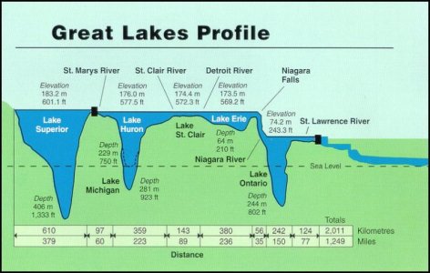
The largest and deepest Great Lake is Lake Superior.
The shallowest Great Lake is Lake Erie (hence, the reason is had become so polluted, that it actually was a "dead" lake 50 years ago, before it recovered).
Maybe, but I am sure if people were honest over 50% of JUB members probably couldn't tell you the Great Lakes either.
Here's a song to help with the State Capitols (if needed):

Lake Superior is known as 'Gitchi Gumee' (with various spellings) in the Ojibway language and means 'Big Sea' or 'Huge Water'. Early explorers mistook it as the Pacific Ocean.
Lake Erie is larger in surface area than Lake Ontario (the smallest Great Lake), but, because of Lake Ontario's depth, it holds about 4 times the water.
